

Introduction
Across Nigeria, the relationship between climate, natural resources, and security is becoming increasingly evident. Rising temperatures, irregular rainfall patterns, prolonged droughts, flooding, and land degradation continue to place pressure on farming communities, pastoral livelihoods, and critical infrastructure. These environmental changes often intensify competition over scarce resources, creating conditions that can contribute to local conflicts and displacement. In this context, weather stations are no longer simply instruments for measuring atmospheric conditions; they are becoming strategic assets for conflict mapping, early warning systems, renewable energy planning, and evidence-based policymaking.
Overview
Modern weather stations generate continuous streams of real-time data on wind speed, temperature, humidity, atmospheric pressure, rainfall, and solar radiation. When integrated with Geographic Information Systems (GIS), satellite imagery, artificial intelligence, and conflict databases, these datasets help governments, researchers, humanitarian organizations, and energy developers identify emerging risks before they escalate into crises (World Meteorological Organization [WMO], 2023).
For the Nigerian Wind Energy Council (NWEC), weather monitoring represents an essential building block for Nigeria’s energy transition. Reliable meteorological data not only supports wind energy development but also strengthens climate resilience, disaster preparedness, environmental planning, and conflict prevention.
Understanding Weather Stations and Their Importance
A weather station is a collection of instruments designed to measure and record atmospheric conditions over time. Depending on its configuration, a station may collect information on:
- Wind speed and direction
- Temperature
- Relative humidity
- Rainfall
- Atmospheric pressure
- Solar radiation
Modern automatic weather stations transmit this information digitally at regular intervals, creating continuous datasets that can be accessed remotely and analysed in real time (WMO, 2023). For renewable energy development, this information is invaluable. Wind developers rely on years of high-quality wind measurements before investing millions of dollars in new projects.
Accurate weather observations reduce investment uncertainty, improve project design, and increase investor confidence. However, the applications extend far beyond energy planning. Weather data can reveal environmental stress patterns that influence agricultural productivity, water availability, migration, and resource competition—all recognised drivers of conflict in many regions.
Climate Change, Resource Competition, and Conflict
Climate change is widely recognised as a “threat multiplier.” Rather than directly causing conflict, changing environmental conditions can worsen existing social, economic, and political vulnerabilities (United Nations Environment Programme [UNEP], 2022).
In Nigeria, changing rainfall patterns and desertification have affected traditional grazing routes and agricultural productivity. Communities that depend on farming and livestock increasingly compete for shrinking resources, creating tensions that may escalate into violence.
Weather stations provide objective environmental evidence that helps decision-makers understand these evolving conditions. Instead of reacting after conflicts emerge, authorities can monitor environmental indicators that signal increasing pressure on vulnerable communities.
For example, prolonged rainfall deficits measured across multiple weather stations may indicate worsening drought conditions. Combined with agricultural production data and population movement information, these observations can help predict areas where intervention may be required. Such proactive approaches shift security planning from crisis response toward prevention.
Today, weather station data adds an environmental dimension to conflict analysis. Several environmental indicators have direct relevance to conflict mapping:
- Rainfall anomalies: Significant deviations from historical rainfall averages may signal drought or flooding, affecting livelihoods.
- Temperature trends: Rising temperatures influence water availability, crop productivity, and heat stress.
- Wind patterns: Wind observations help monitor dust transport, wildfire behaviour, and the potential of renewable energy.
- Humidity and atmospheric conditions: These measurements contribute to understanding ecosystem changes and agricultural productivity.
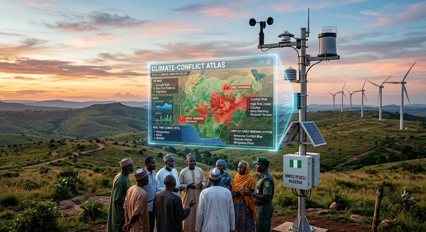
When integrated into Geographic Information Systems (GIS), these variables create dynamic maps that identify environmental hotspots alongside social and economic indicators. This approach enables policymakers to allocate resources more effectively while supporting humanitarian agencies in targeting interventions before environmental stress translates into instability.
Data Signals and Early Warning Systems
One of the greatest strengths of automated weather stations is their ability to continuously transmit information. Unlike traditional manual observations, modern stations generate near real-time data that can be integrated into digital dashboards, cloud platforms, and early warning systems. These data signals support multiple applications:
- Flood forecasting
- Drought monitoring
- Agricultural advisory services
- Renewable energy forecasting
- Disaster risk reduction
- Conflict early warning
When environmental thresholds are exceeded, automated alerts can notify authorities, researchers, emergency managers, or local communities. For example, an extended period of declining rainfall combined with increasing temperatures may trigger drought advisories. Humanitarian organisations can then prepare water supplies, agricultural support programmes, or livelihood assistance before communities reach crisis levels.
Similarly, real-time wind measurements improve electricity generation forecasting for wind farms while supporting aviation safety and infrastructure management. The integration of weather stations with digital communication systems enables faster, more coordinated responses to emerging environmental risks.
NWEC’s Weather Station Deployment: Building Nigeria’s Climate Intelligence
The Nigerian Wind Energy Council has recognised that robust renewable energy planning begins with robust data. As part of its commitment to evidence-based energy development, NWEC has collaborated with the Plateau State Energy Corporation (PSEC) in deploying weather monitoring stations across Plateau State. These installations are designed to generate reliable, site-specific meteorological information that supports wind resource assessment, renewable energy investment, and sustainable infrastructure planning.
Recent updates from NWEC have highlighted stations already producing real-time measurements of wind speed, temperature, humidity, solar radiation, and atmospheric pressure, including data generated from the Shendam monitoring station (NWEC, 2025). These stations represent far more than scientific equipment. They form part of a growing climate intelligence network capable of supporting multiple sectors simultaneously. Investors can use the information to evaluate wind energy potential. Researchers can analyse long-term climate trends. Policymakers can make evidence-based infrastructure decisions. Communities benefit from improved understanding of local environmental conditions.
The partnership with Plateau State Energy Corporation demonstrates the value of collaboration between government institutions and industry stakeholders in building the technical foundation required for Nigeria’s clean energy future. Importantly, every additional weather station expands the country’s environmental observation capacity, reducing data gaps that have historically limited climate modelling and renewable energy planning.
Integrating Weather Data with Artificial Intelligence
The future of conflict mapping lies not only in collecting data but also in analysing it intelligently. Artificial intelligence and machine learning can process enormous volumes of weather observations alongside satellite imagery, demographic information, agricultural statistics, and historical conflict records.
These technologies identify patterns that may not be immediately visible to human analysts. For instance, algorithms can detect combinations of declining rainfall, increasing temperatures, reduced vegetation cover, and migration trends that have historically preceded localised conflicts. Predictive models can then assign risk scores to specific geographic areas, enabling preventive interventions.
Similarly, renewable energy developers can combine weather station data with AI-powered forecasting models to improve electricity generation predictions, optimise turbine operations, and strengthen grid stability. The integration of weather stations, AI, and digital mapping, therefore, creates opportunities for smarter climate adaptation and more resilient energy systems. NWEC’s ongoing weather station deployment demonstrates how sector-specific investments can yield broader national benefits, extending beyond renewable energy into climate resilience, disaster preparedness, and conflict prevention.
Conclusion
Weather stations are rapidly evolving from simple meteorological instruments into strategic national assets that support sustainable development, renewable energy expansion, and environmental security. Their ability to generate continuous, real-time data provides decision-makers with the information needed to anticipate environmental risks, strengthen infrastructure planning, improve disaster preparedness, and support conflict mapping initiatives.
For Nigeria, where climate variability increasingly intersects with economic development and community resilience, expanding weather observation networks is both a scientific necessity and a strategic investment. The Nigerian Wind Energy Council’s deployment of weather monitoring stations across Plateau State illustrates how climate data can serve multiple purposes simultaneously, advancing wind energy development while creating valuable environmental intelligence for policymakers, researchers, and local communities.
As Nigeria continues its energy transition and climate adaptation journey, weather stations will remain critical tools for transforming raw environmental observations into actionable signals that inform smarter decisions, reduce vulnerabilities, and build a more resilient future.
References
United Nations Environment Programme (UNEP). (2022). Climate change and security: Understanding climate as a threat multiplier.
World Meteorological Organization (WMO). (2023). Guide to Instruments and Methods of Observation (WMO-No. 8).
World Meteorological Organization (WMO). (2023). State of the Global Climate Report.
